Transportation Projects
Street Closures, Restrictions and Construction Notices
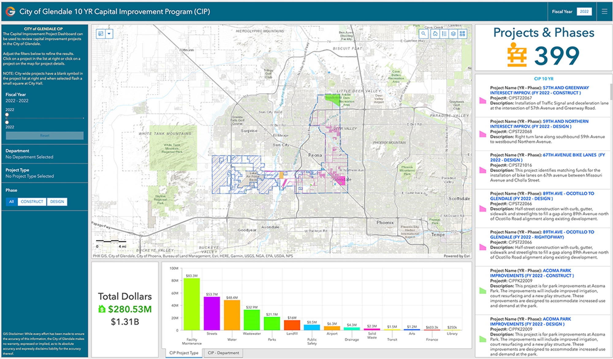
City of Glendale 10 YR Capital Improvement Program (CIP) Dashboard
Current Projects
Infill Streetlighting Project
City of Glendale residents have requested additional streetlighting to be installed in their neighborhoods due to dark areas. The Transportation Department responded to these requests by creating a new project to install streetlights in the requested areas to increase safety. Phase one (1) of the project was recently completed in Summer 2025 with 79 new streetlights installed in various locations. Phase two (2) of the project is currently in design with an estimate of 69 new streetlights to be installed. To ensure communication, the City is using an outreach service that will notify residents about a month before construction begins in their area.

Pavement Management
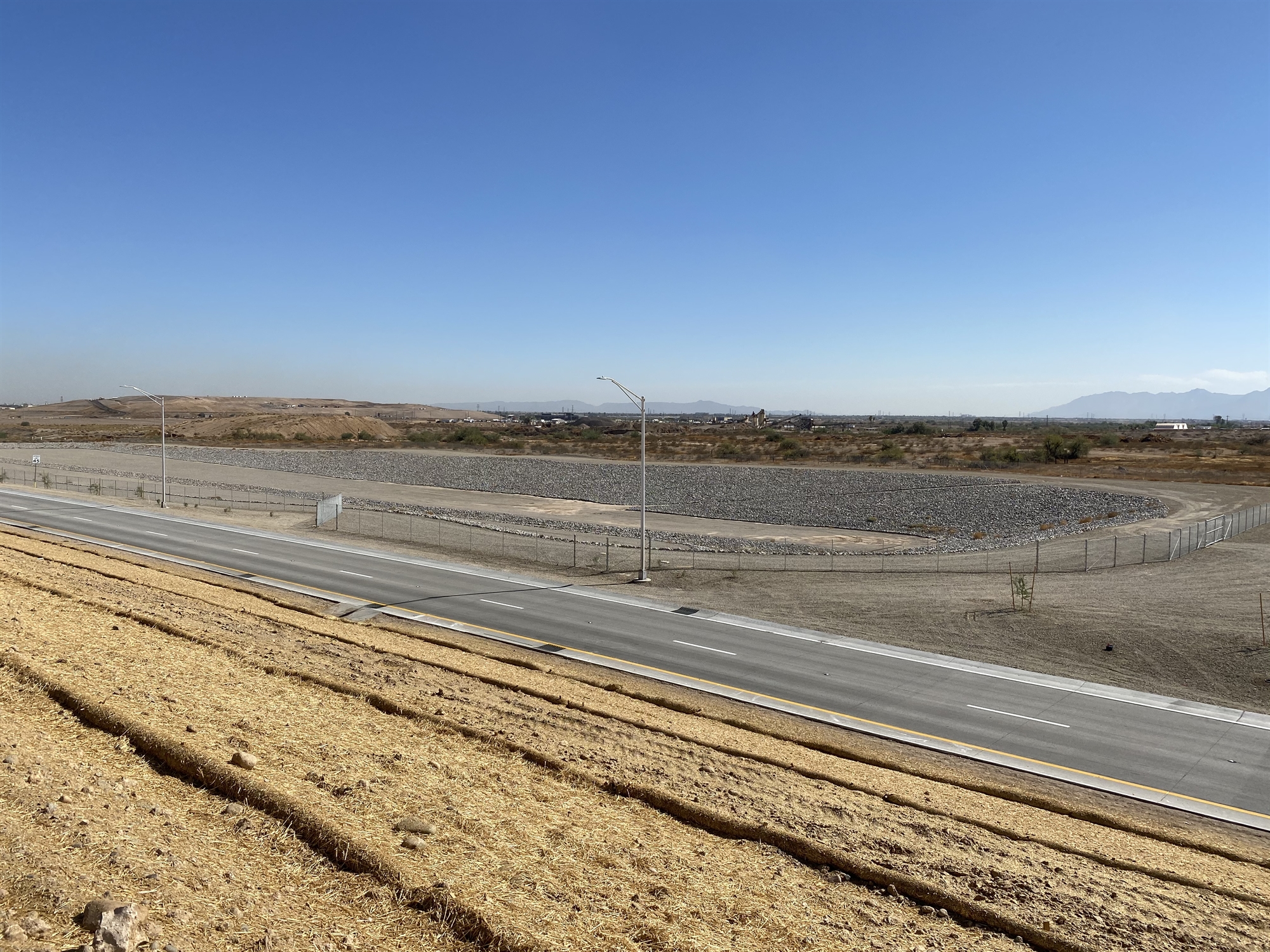
The City of Glendale’s Transportation Department is continuously working to improve and maintain its roadway network. Maintaining a strong network of streets is beneficial to everyone at the regional and local level for connectivity, safety and economic growth.
The current roadway network is comprised of approximately 748 centerline miles of roadway which is just over 17 million square yards of asphalt and concrete surfacing. It is estimated that the average complete replacement cost for a major roadway is between $3.2-$3.5 million per mile. This indicates a very large amount of funding invested in pavement roadway networks nationwide and specifically within the City of Glendale. Given the high costs of reconstruction, it is imperative to maintain and extend the life of the existing pavement surface to the maximum extent possible.
The city has developed a Pavement Management Program (PMP) to best address street pavement needs. Visit the Pavement Management page.
Central Core Sidewalk Infill Project
The Maricopa Association of Governments (MAG) and the Arizona Department of Transportation have awarded the City design and construction funding to close sidewalk gaps in Glendale's Central Core area near downtown. The project will improve sidewalk connectivity and pedestrian mobility throughout the area by constructing missing sidewalk segments that range between 65 feet to 1,320 feet (0.25 miles) in length and are located on 11 streets within a 1.4 square mile area.
Where are we now?
Construction will begin January 2026.
The design phase of the project was initiated in January 2022. The City held an open house public meeting in September 2022 to provide information about the project and solicit input from the public and other stakeholders. You can access material from the public meeting by following the links below:
Need more information?
If you have any questions about the project please use the following contact options:
- Phone: 602.532.6250
- Email: transportationinfo@glendaleaz.com
Maryland Active Transportation Improvements
The Maricopa Association of Governments (MAG) has awarded the City design and construction funding to close sidewalk gaps and improve bicycle facilities in the area between Maryland Avenue and Bethany Home Road. The map below shows the project area, which is also bounded by 43rd Avenue to the east and 59th Avenue to the west.
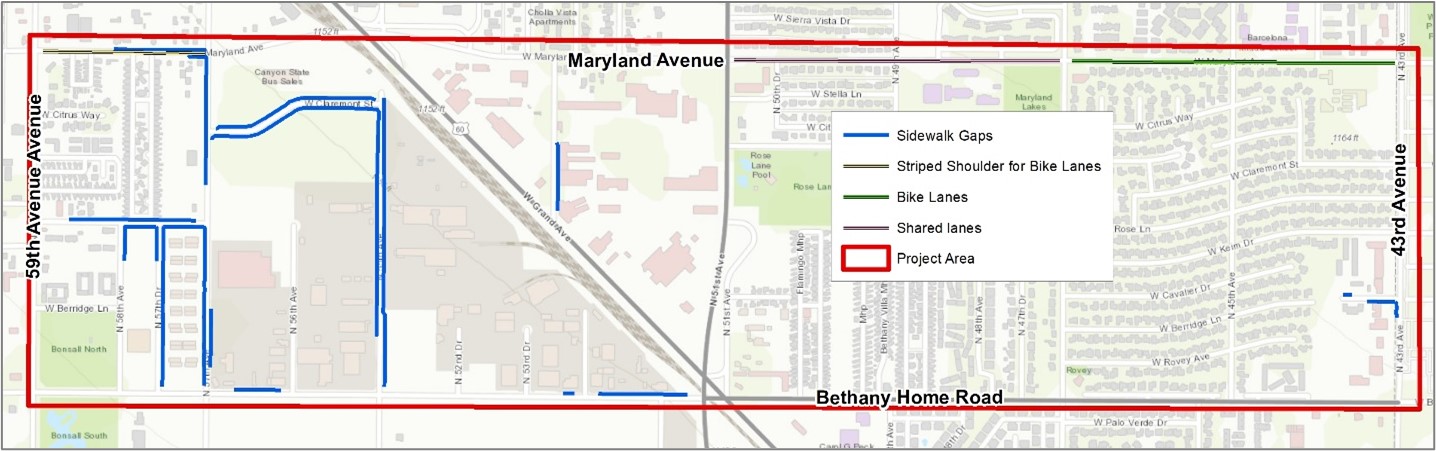
The objective of the project is to improve mobility and access to businesses, bus stops and residences. The project area includes more than three total linear miles of missing sidewalk. Potential improvements to bicycle facilities in this area will also be evaluated, including addressing gaps in the system. Design activities are expected to begin in late fall of 2022.
Missouri Active Transportation Improvements
The Maricopa Association of Governments (MAG) has awarded the City design and construction funding to close sidewalk gaps and improve bicycle facilities in the area immediately west of Grand Avenue, between Missouri Avenue and Bethany Home Road. The project area is also bounded by 61st Avenue on the west, and 55th Avenue and 51st Avenue on the east. A map showing the project location is provided below.
 (PDF, 545KB)
The objective of the project is to improve mobility and access to businesses, bus stops and residences. The project will construct approximately 2.2 total linear miles of missing sidewalk, 1.5 miles of new bicycle lanes, and 0.5 mile of shared bicycle facilities.
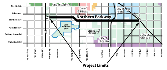
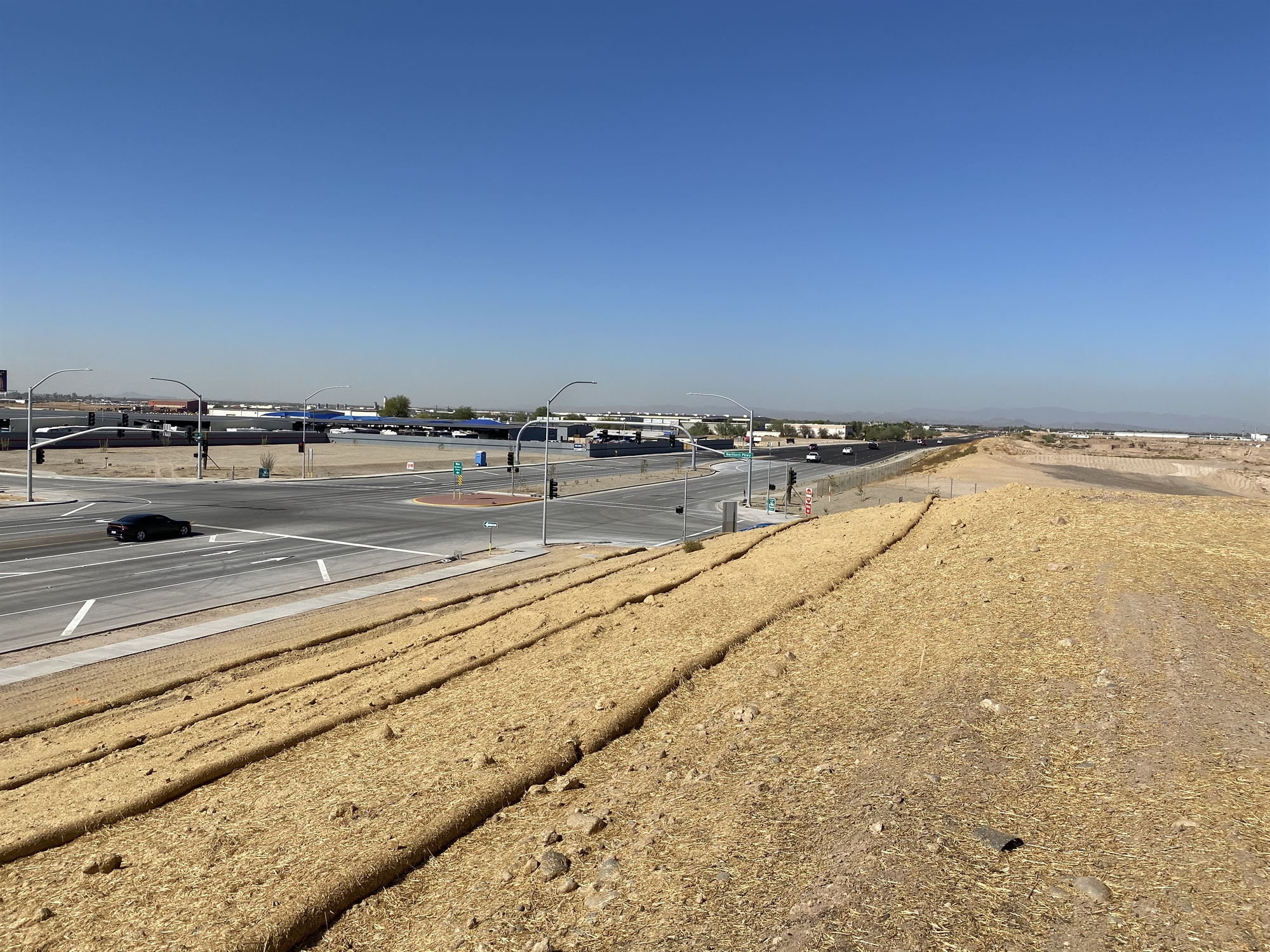
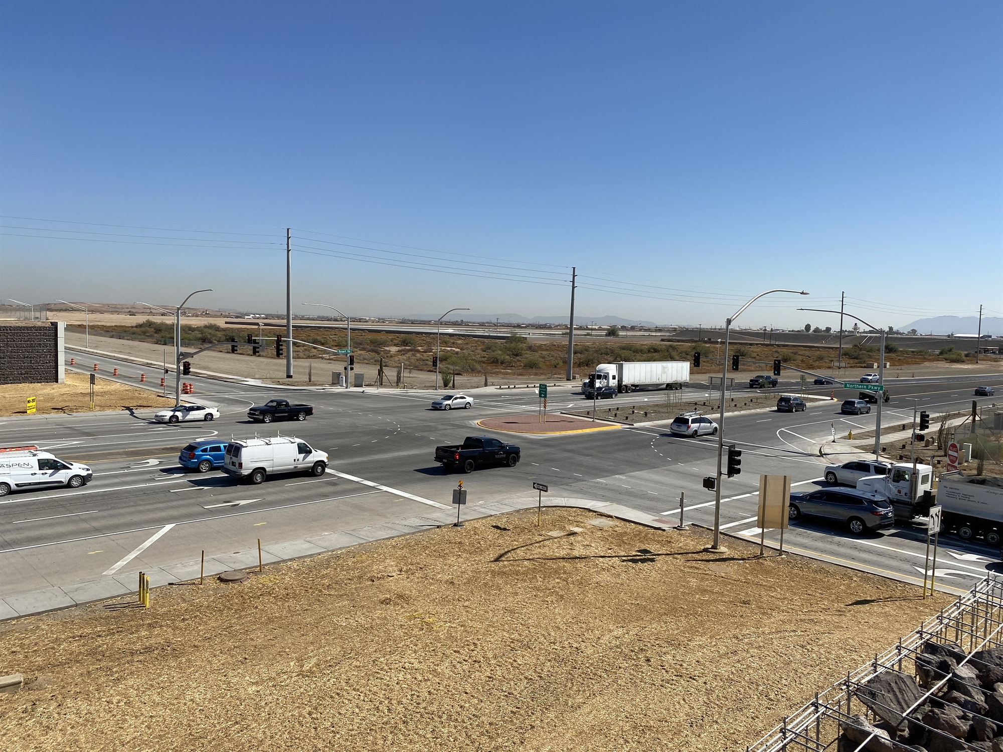
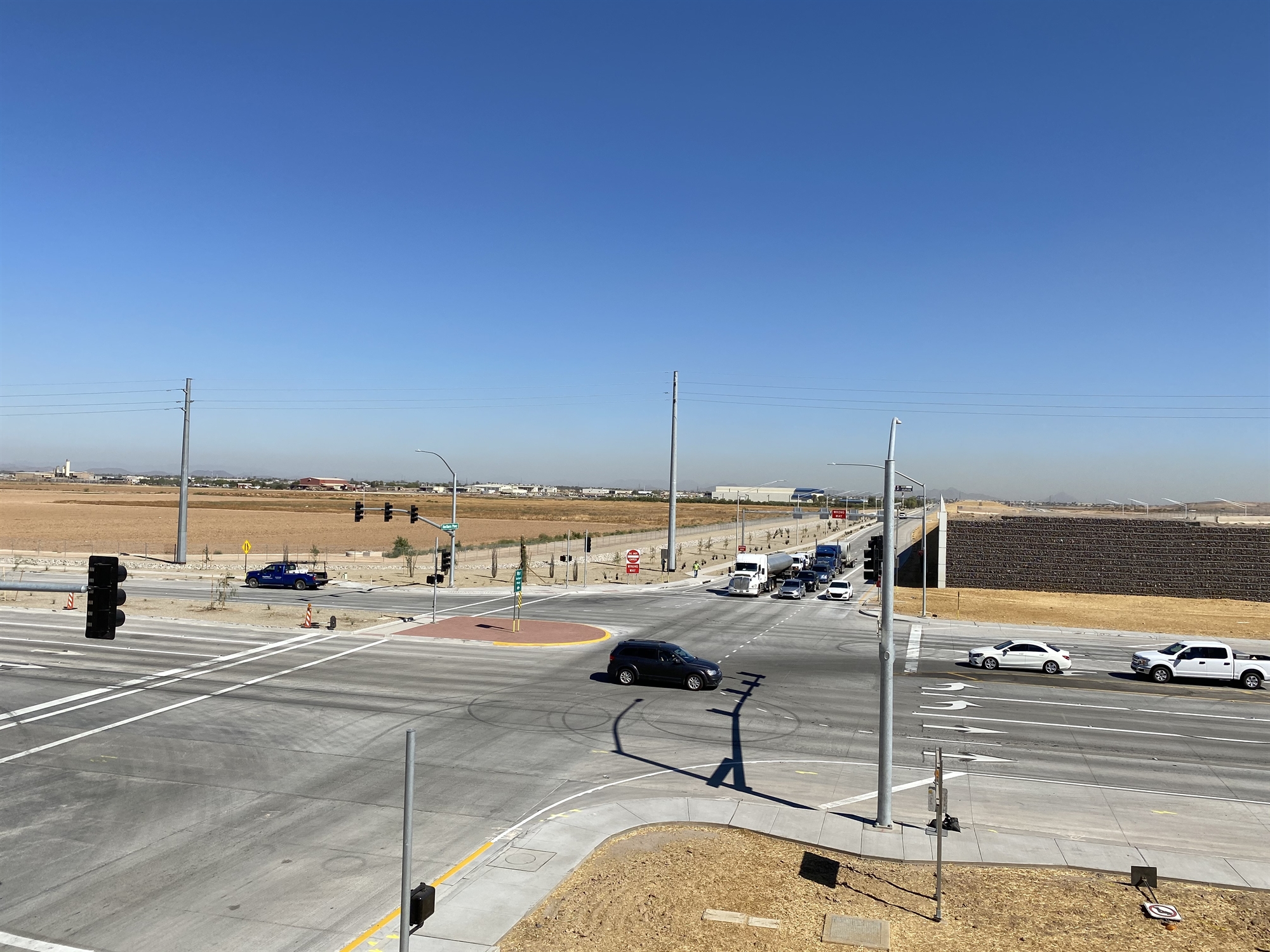
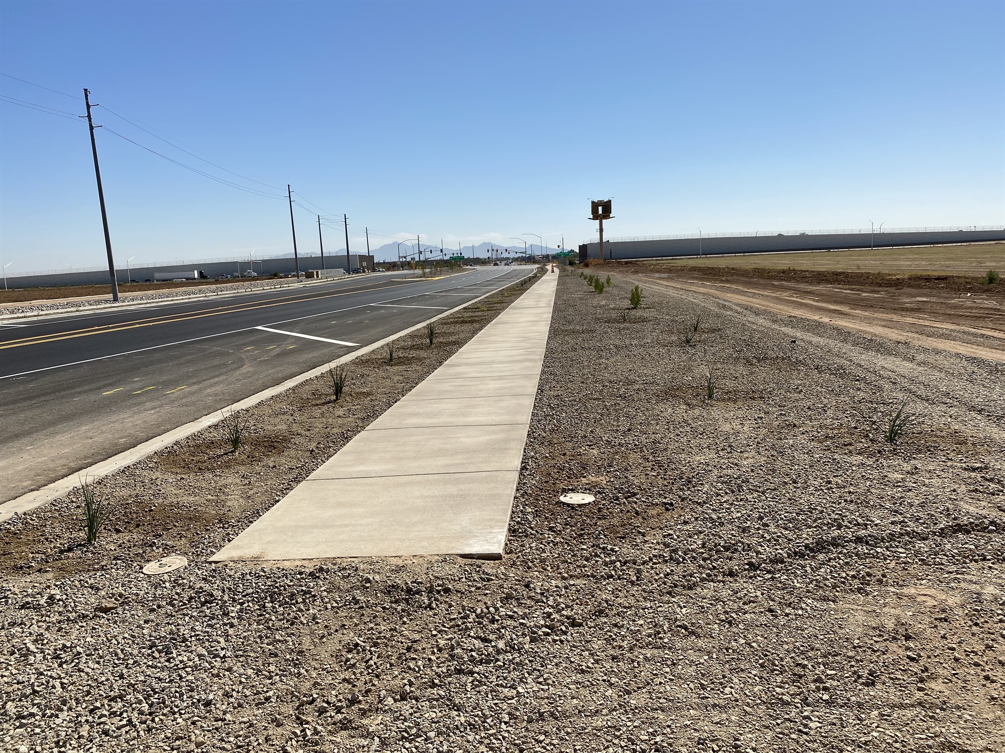
Northern Parkway Project
The Northern Parkway project extends 12.5 miles between Loop 303 and US 60 (Grand Avenue) in northwestern Maricopa County. When completed, Northern Parkway will be a high capacity, limited access roadway with overpasses at major intersections. The project is a partnership between Maricopa County, the Cities of El Mirage, Glendale and Peoria, and the Maricopa Association of Governments (MAG).
For more information visit project web page hosted by Maricopa County Department of Transportation.
Information Flyer(PDF, 522KB)
Project Photos

HAWK Pedestrian Crossing Signals
A HAWK (High-Intensity Activated Crosswalk) pedestrian beacon that resembles a traffic signal light, but is pedestrian activated, have been installed at five locations in Glendale. Traffic is stopped only when the push-button is activated by someone waiting to cross the roadway. A new single north/south crosswalk was installed at the west leg of the intersection. Additional improvements included the installation of new sidewalk, curb and gutter, ADA-compliant sidewalk ramps, reflective pavement markings and other related activities.
HAWK locations include:
- 60th Avenue and Bethany Home Road
- 65th Avenue and Glendale Avenue
- 63rd Avenue and Beardsley Avenue
- 65th Avenue and Bethany Home Road
- 6002 N. Ballpark Boulevard
- 53rd Avenue and Camelback Road
- 58th Avenue and Bethany Home Road
- 67th Avenue and Montebello Avenue
Future HAWK locations include:
- 59th Avenue and Evergreen Road
Additional Resources:

Flashing Yellow Arrow
 The use of flashing yellow arrows (FYA) at signalized intersections to control left turning traffic was recently approved by the federal government after studies concluded that flashing arrows provide numerous benefits including:
- Enhanced understanding by motorists when using arrows instead of solid green indications;
- Enhanced safety; and
- Improved operation by minimizing delays.
FYA at a traffic signal includes a flashing yellow arrow signal head in addition to the standard red, yellow and green arrow heads over the left-turn lane. When illuminated, the flashing yellow arrow allows waiting motorists to make a left-hand turn after yielding to oncoming traffic. Otherwise, the new traffic signals work the same as traditional signals. The City of Glendale has begun a program to convert left-turn movements at various signalized intersections to FYA operation with the purpose of improving safety and operations.
Flashing Yellow Arrow Program Status Update
| N/S Street |
E/W Street |
Phase |
Design Status |
| 51st Ave |
Northern Ave |
1 |
Complete |
| 51st Ave |
Olive |
1 |
Complete |
| 51st Ave |
Peoria Ave |
1 |
Complete |
| 59th Ave |
Bell Road |
1 |
Complete |
| 59th Ave |
Bethany Home Road |
1 |
Complete |
| 59th Ave |
Northern Ave |
1 |
Complete |
| 59th Ave |
Peoria Ave |
1 |
Complete |
| 59th Ave |
Thunderbird Road |
1 |
Complete |
| 67th Ave |
Bell Road |
1 |
Complete |
| 67th Ave |
Olive Ave |
1 |
Complete |
| 67th Ave |
Glendale Ave |
1 |
Complete |
| 75th Ave |
Glendale Ave |
1 |
Complete |
| 115th Ave/Landfill |
Glendale Ave |
2 |
Complete |
| 51st Ave |
Glendale Ave |
2 |
Complete |
| 59th Ave |
Glendale Ave |
2 |
Complete |
| 59th Ave |
Olive Ave |
2 |
Complete |
| 59th Ave |
Union Hills Drive |
2 |
Complete |
| 67th Ave |
Deer Valley Road |
2 |
Complete |
| 67th Ave |
Parkside Ln/Pinnacle Peak |
2 |
Complete |
| 75th Ave |
Deer Valley Road |
2 |
Complete |
| 83rd Ave |
Bethany Home Road |
2 |
Complete |
| 99th Ave |
Bethany Home Road |
2 |
Complete |
| Dysart Road |
Glendale Ave |
2 |
Complete |
| El Mirage Road |
Glendale Ave |
2 |
Complete |
| 91st Ave |
Montebello Ave |
2 |
Complete |
| 95th Ave |
Camelback Road |
2 |
Complete |
| 45th Ave |
Glendale Ave |
2 |
Complete |
| 99th Ave |
Maryland Ave |
2 |
Complete |
| 91st Ave |
Cardinals Way |
2 |
Complete |
| 87th Ave |
Cardinals Way |
2 |
Complete |
| 91st Ave |
Zanjero Blvd |
2 |
Complete |
| 63rd Ave |
Northern Ave |
2 |
Complete |
| Logistics Way |
Glendale Ave |
2 |
Complete |
| 51st Ave |
Camelback Road |
N/A |
Complete |
| 59th Ave |
Camelback Road |
3 |
2026 Construction |
| 59th Ave |
Deer Valley Road |
N/A |
Complete |
| 59th Ave |
Greenway Road |
3 |
2026 Construction |
| 67th Ave |
Bethany Home Road |
3 |
2026 Construction |
| 67th Ave |
Cactus Road |
3 |
2026 Construction |
| 67th Ave |
Peoria Ave |
3 |
2026 Construction |
| 83rd Ave |
Camelback Road |
3 |
2026 Construction |
| 83rd Ave |
Glendale Ave |
3 |
2026 Construction |
| 99th Ave |
Camelback Road |
3 |
2026 Construction |
| 99th Ave |
Glendale Ave |
3 |
2026 Construction |
| 47th Ave |
Olive Ave |
4 |
Complete |
| 55th Ave |
Olive Ave |
4 |
Complete |
| 67th Ave |
Butler Dr |
4 |
Complete |
Vision Zero Plan & Safety Action Plan
Title: Vision Zero Plan & Safety Action Plan
In partnership with the USDOT and as a recipient of the Safe Streets and Roads for All (SS4A) Grant Program, the City of Glendale, Arizona is developing comprehensive Vision Zero and Safety Action Plans.
For further information, please visit this link:Safe Streets for Glendale
Recently Completed Projects
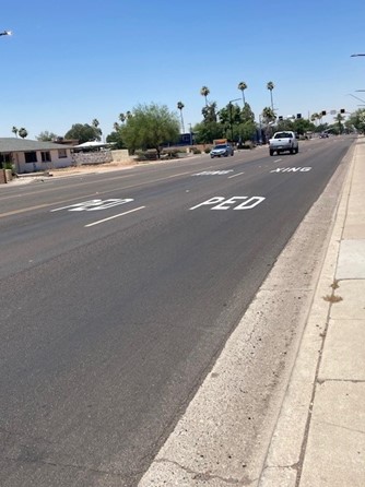
Pavement Markings
The City of Glendale’s Traffic Mitigation division completed the installation of “Ped Xing” pavement markings in advance of 4 HAWK Pedestrian Signals. The locations were as follows:
- Glendale Avenue and 65th Avenue
- Bethany Home Road and 60th Avenue
- Bethany Home Road and 65th Avenue
- Ball Park Boulevard at the New River Trail
The pavement markings were added to enhance safety by bringing additional attention to the signalized crosswalk at the locations mentioned above.