Flood Zone Determinations
Homes and business properties located in high-risk flood areas with government-backed mortgages are required to have flood insurance. This insurance is through the National Flood Insurance Program (NFIP) - Risk Rating 2.0.
The City of Glendale participates in the NFIP thru the Community Rating System (CRS) program which is administered and overseen by the Engineering Department.
Glendale is a CRS Class 7 rating gives a 15% premium reduction to flood insurance policies for properties within the high-risk flood areas and properties.
Property owners can request a Flood Zone Determination by filling out the Flood Zone Determination Form(PDF, 139KB) . This form can be emailed to jtrasancos@glendaleaz.com, or in person to the Glendale Bead Museum, Mapping Department located at 5754 W. Glenn Dr., Glendale, AZ 85301.
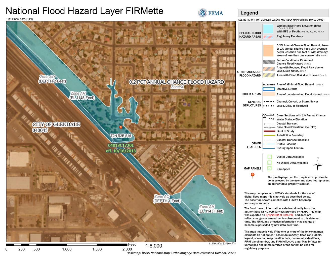
To view the Flood Control District of Maricopa County's Floodplain Viewer select - Floodplain and Elevation Certificate Viewer. Then you can enter your address and see where your property is in relation to the floodplain or if the County has a copy of an Elevation Certificate for your property.